
Where Is This Place?
Upload any photo, screenshot, or image and let WhereWasTaken use AI image geolocation to identify where the place is located. Analyze landmarks, architecture, roads, and landscapes to estimate the most likely location.
Drop your photo here
or click to upload
JPG, PNG, WEBP, HEIC • Max 10MB
Not sure what to upload? Try one of these:
- AI-Powered Geolocation
- Evidence-Based Reasoning
- No GPS Required
Wondering "Where Is This Place?"
People ask "Where is this place?" when they discover an interesting location but cannot identify where it is. AI image geolocation analyzes visual clues from photos, screenshots, and images to estimate the most likely location.
Identify Unknown Places
Upload photos of streets, buildings, or unfamiliar places and let AI analyze visual geographic clues to estimate where they are located.
Find Travel Destinations
Upload travel photos and discover where they were taken before planning your next trip.
GeoGuessr Location Solver
Analyze streets, signs, landscapes, and regional clues to improve your GeoGuessr skills.
Identify Places from Screenshots
Analyze screenshots from social media, websites, or online posts to discover where they were taken.
Find Video Locations
Upload screenshots from movies, videos, or online clips to identify filming locations and memorable places.
Rediscover Old Photos
Find where your old travel photos were taken and rediscover forgotten memories.
What Types of Places Can AI Find from a Photo?
AI analyzes visual geographic clues to estimate locations across different environments, from famous landmarks and city streets to natural landscapes and remote areas.
Famous Landmarks
Recognize iconic monuments, attractions, historical sites, towers, temples, and distinctive buildings using visual clues.
Cities and Streets
Analyze streets, architecture, road signs, urban layouts, and infrastructure to estimate cities and neighborhoods.
Natural Landscapes
Analyze beaches, mountains, forests, lakes, deserts, and national parks using terrain, vegetation, and environmental clues.
Rural and Remote Areas
Estimate unknown rural locations by analyzing terrain, vegetation, climate, and geographic patterns.
How Does AI Find Where This Place Is?
Instead of searching for identical images online, AI image geolocation analyzes visual geographic clues and reasoning patterns to estimate the most likely location.
1. Upload Your Image
Upload a photo, screenshot, or GeoGuessr round to start the AI location analysis.
2. Analyze Visual & Geographic Clues
AI analyzes landmarks, architecture, roads, signs, landscapes, and environmental details to identify geographic patterns.
3. Determine the Most Likely Location
AI uses geographic context and patterns to estimate the most likely country, region, or city.
4. Explore the Location Evidence
View the predicted location with confidence score, map, and the evidence behind the prediction.
What Will You Get from AI Location Analysis?
AI provides more than a location prediction. You receive visual geographic evidence explaining why the location was estimated.
Estimated Location
View the predicted country, region, city, and coordinates based on AI image geolocation analysis.
Visual Geographic Evidence
Explore the landmarks, architecture, roads, landscapes, and other clues used to estimate the location.
Location Confidence
See the confidence level of the prediction and understand how reliable the result is.
Possible Locations
Explore other locations considered by AI during the analysis.
Interactive Map
View the estimated location on a map and explore the surrounding area.
Where Is This Place? AI Photo Location Examples
Explore real AI photo location analysis examples and see how visual geographic clues help identify the most likely places from images.
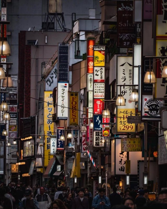
Tokyo, Japan
Key Location Clues
- Japanese Script
- Vertical Signage Density
- Highball Price Sign
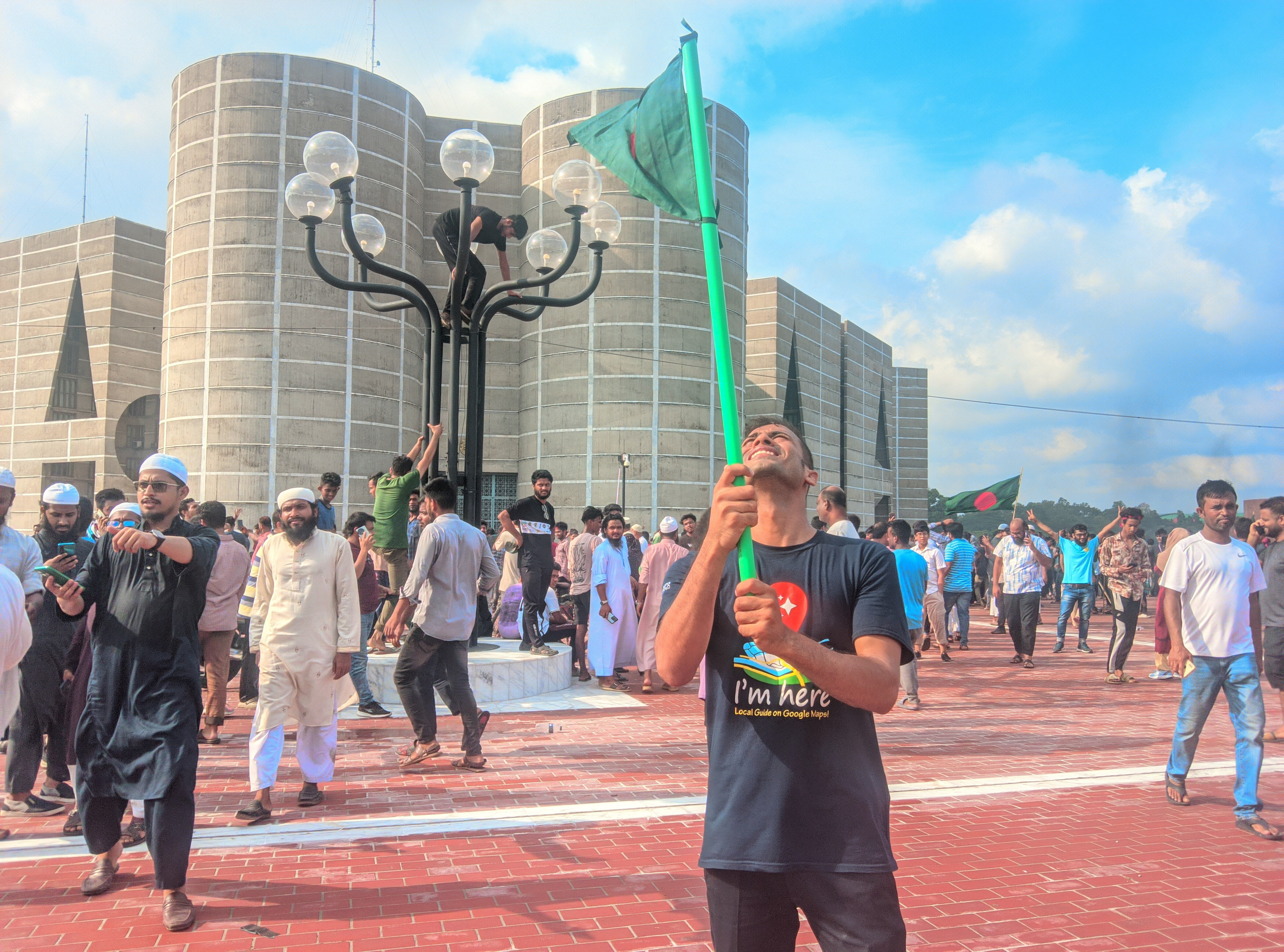
Dhaka Division, Bangladesh
Key Location Clues
- Jatiya Sangsad Bhaban
- National Flag
- Clothing
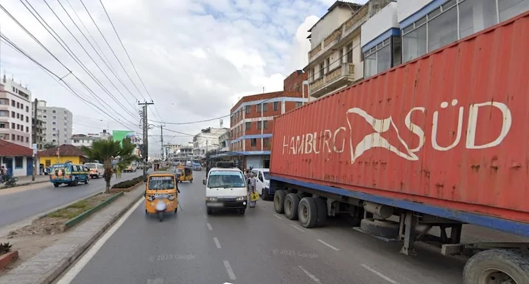
Dar es Salaam Region, Tanzania
Key Location Clues
- Hamburg Süd Container
- Tuk-tuks (Bajajis)
- Urban Buildings
Frequently Asked Questions
Explore Related Resources
Discover more AI-powered tools and guides to identify photo locations, recognize landmarks, read EXIF metadata, check geotags, and solve GeoGuessr screenshots.
Find Location from Photo
Upload a photo or screenshot and let AI analyze visual clues to estimate where it was taken without GPS metadata.
Try ToolIdentify Landmarks from Photos with AI
Upload a photo to recognize landmarks, buildings, monuments, and famous places with AI location analysis.
Try ToolGeoGuessr Image Solver
Analyze GeoGuessr screenshots with AI and identify possible locations using roads, signs, landscapes, and geographic clues.
Try Tool
Find Out Where This Place Is
Upload a photo and use AI image geolocation to estimate the location, analyze geographic clues, and discover why this place was identified.